Self-Sustaining Ocean Observation Station (S.O.O.S)
Problem Identification
The 21st century is the “Sea Century” — but we face growing environmental and economic threats.
- Sea level has risen 8–9 inches since 1880
- Ocean acidity increased — pH dropped from 8.11 to 8.05 in 40 years
- Sea surface temperatures rose by ~0.6°C since 1980
- Tsunamis and hurricanes cause massive loss of life and damage yearly
- Current monitoring tools are costly, slow, and not real-time
A low-cost, real-time, and self-sustaining Smart Ocean Observing System (SOOS) — designed to track ocean conditions and help solve critical environmental and economic challenges.
Prototypes
In our innovation project, we designed a total of four prototypes to continue improving our design.
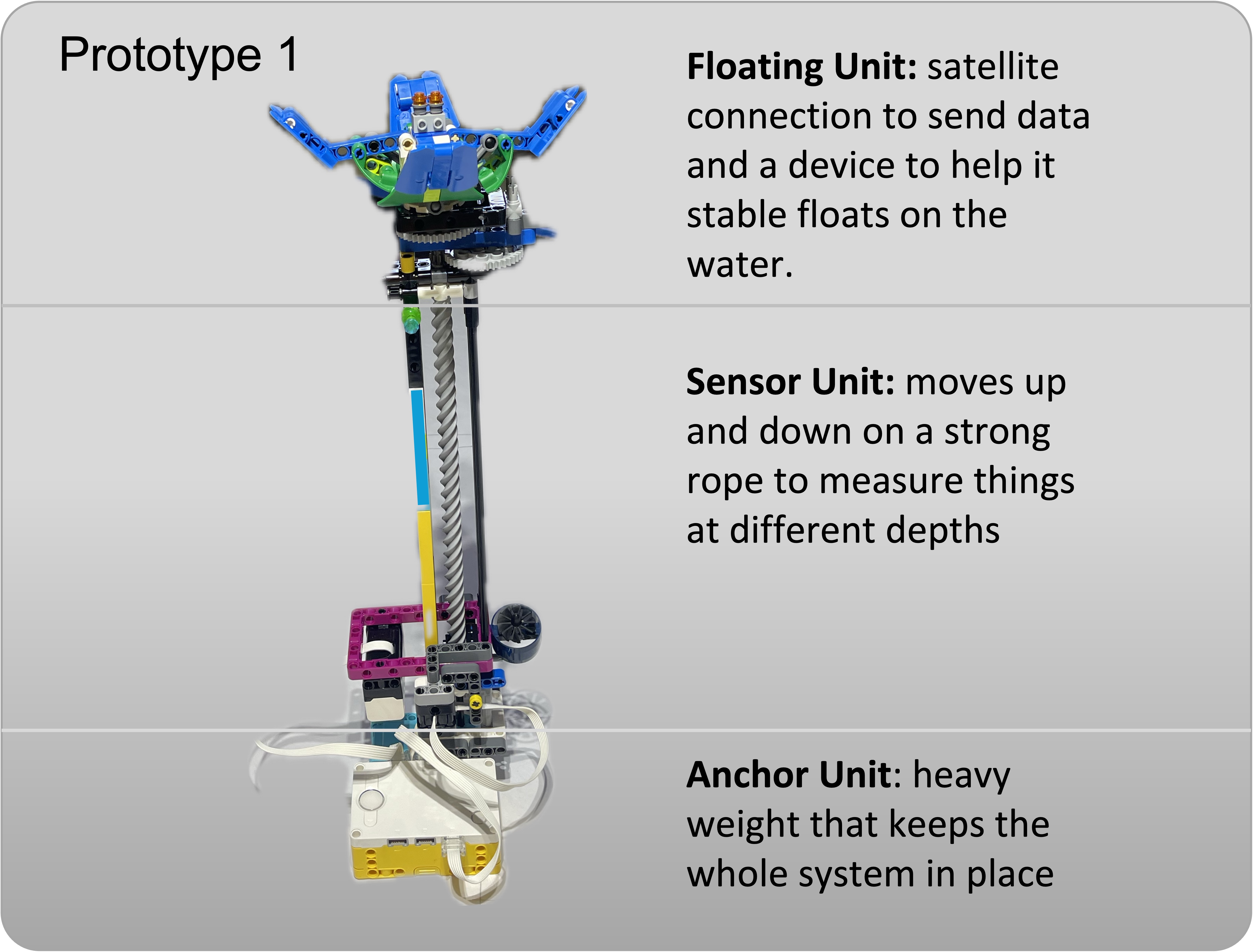
Prototype 1 (Aug 2024)
Three main parts: floating unit with satellite/solar, sensor unit, and anchor unit.
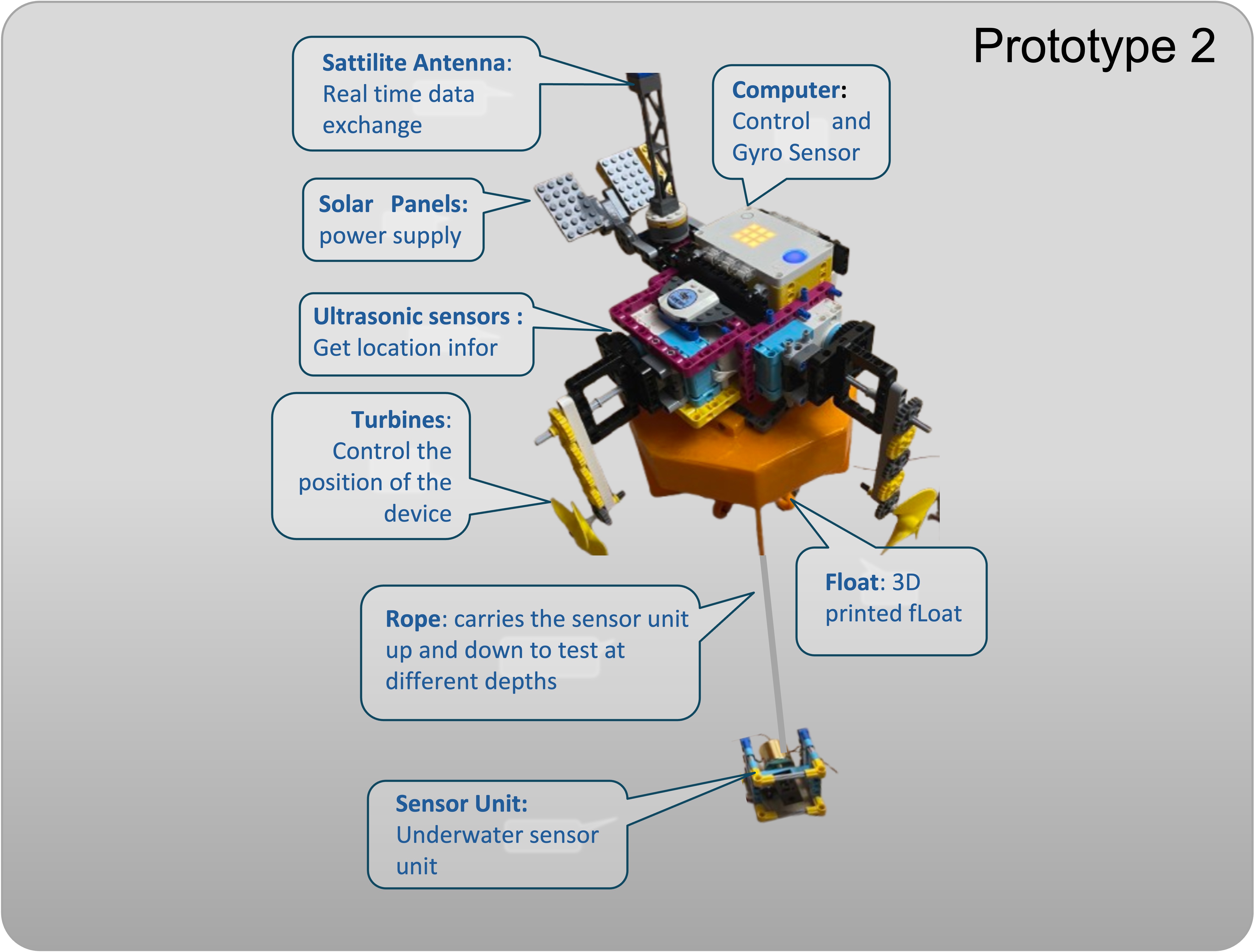
Prototype 2 (Dec 2024)
Mobile unit (anchor removed), propeller system, moving sensor cabinet.
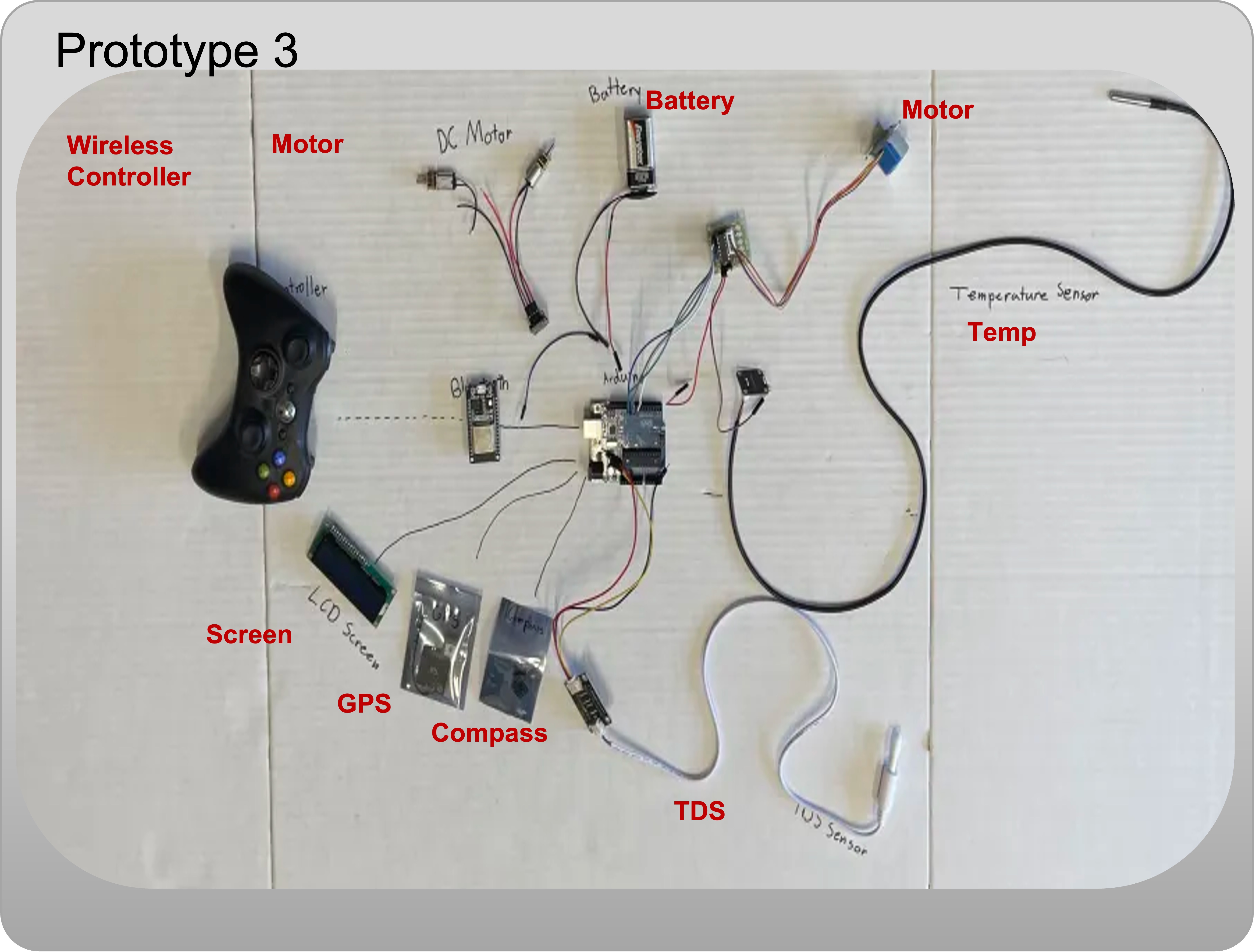
Prototype 3 (Jan 2025)
Shift to Arduino/ESP32. pH, TDS, Temperature sensors. Lower cost.
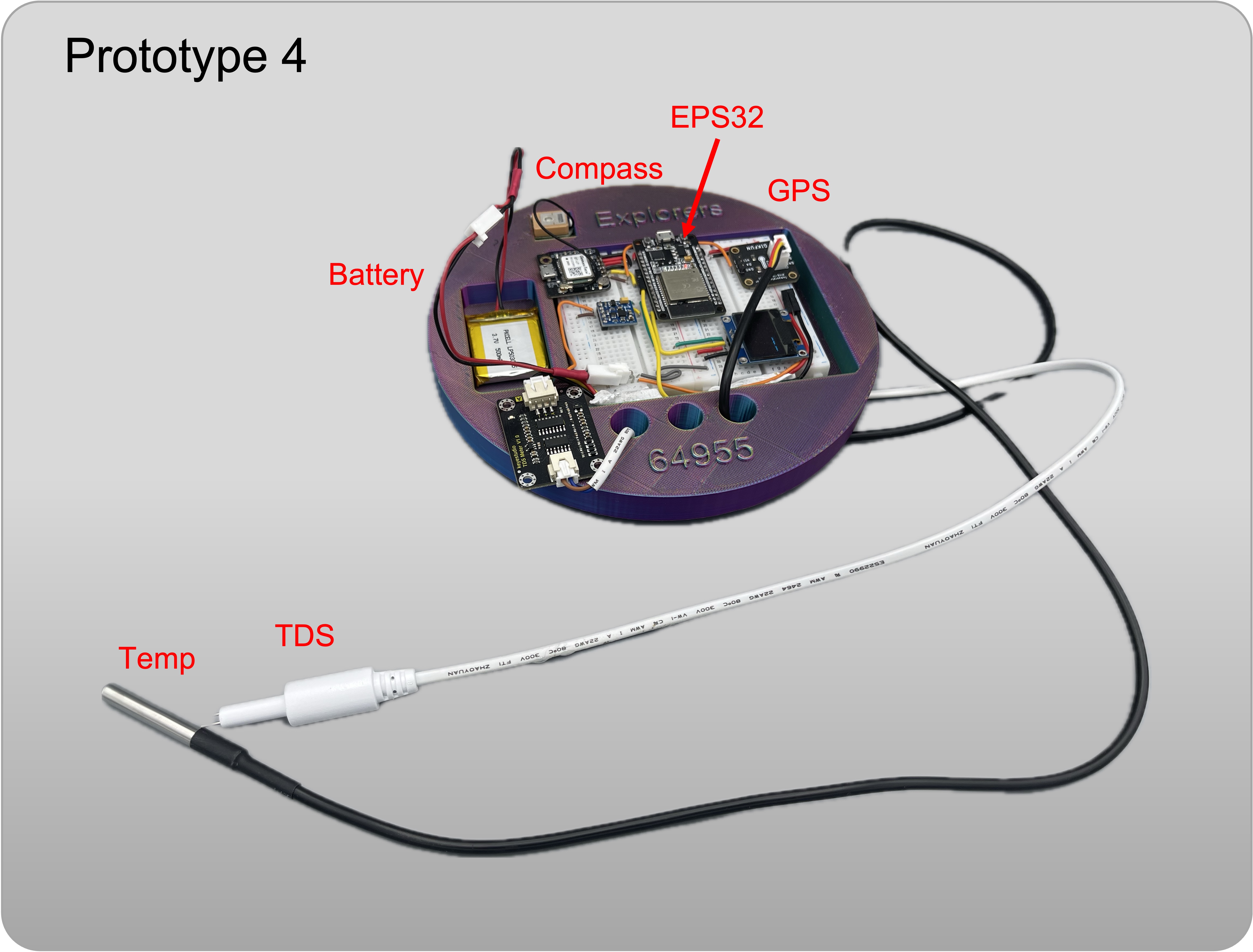
Prototype 4 (April 2025)
Final Design. GPS, Compass, Display, integrated sensors and navigation.
Product Design
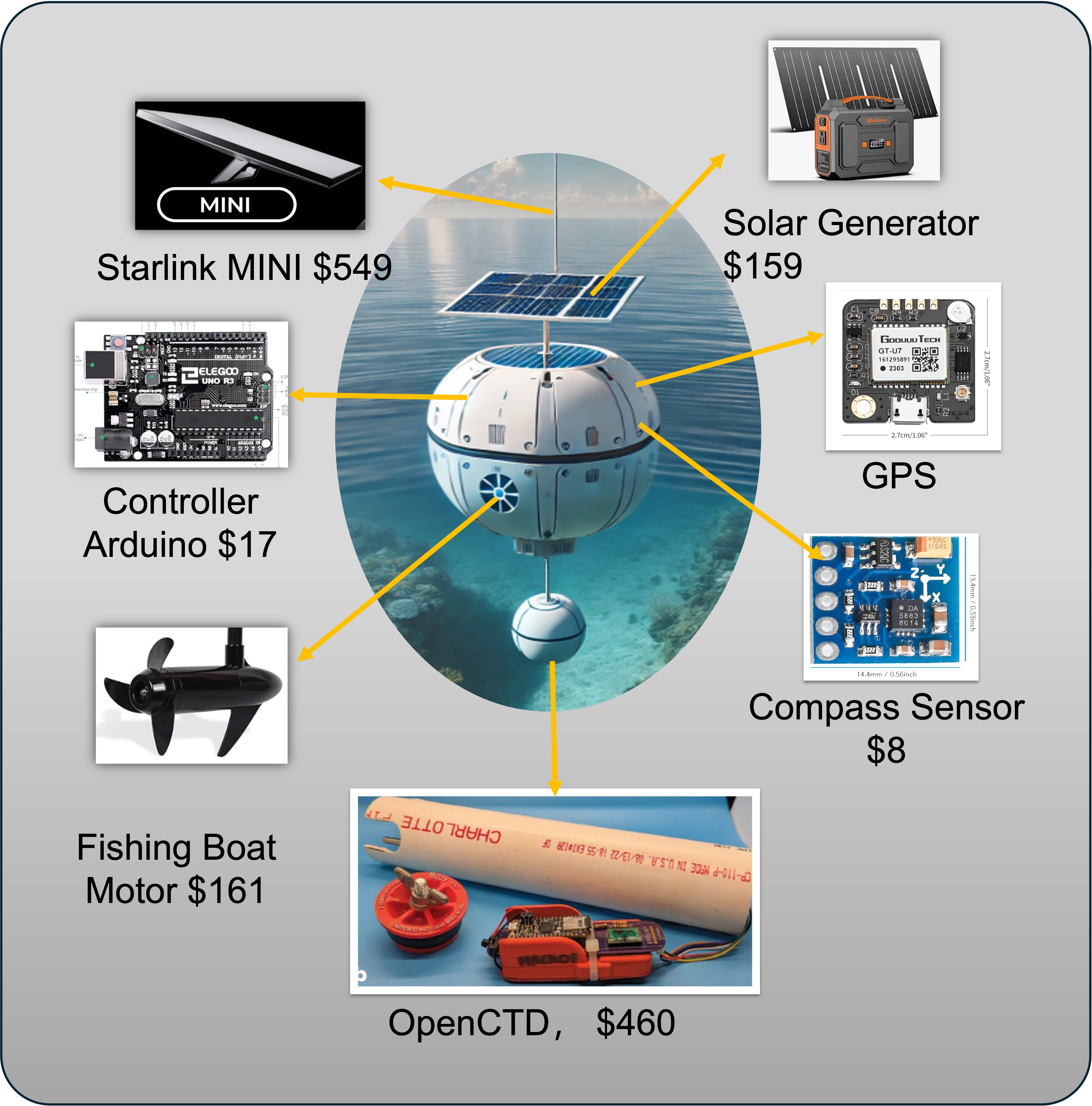
We explored Arduino/Raspberry Pi as the brain. Checked GPS/Compass modules (affordable). Found OpenCTD ($500) as a reference for low-cost scientific instruments.
Experiments
We waterproofed sensors and tested at 4 locations. Surprisingly, a swimming pool had high TDS! We verified that low-cost sensors could reliably measure underwater.
Impact & Applications
- 🪸 Coral Protection: Detect rising temps/pollution.
- 🏔️ Glacier Tracking: Monitor melting shifts.
- 🐟 Marine Life: Observe biodiversity changes.
- 🌊 Tsunami Alerts: Sense seismic shifts early.
Acknowledgements
Thanks to experts from ASU (Prof. Li, Prof. Wang), OdySea Aquarium (Miss Cara), and Dr. Guo/Dr. Shi for their guidance.
ArtiScan
Problem Identification
It is a big challenge for archaeologists to make accurate, real-time, context enriched artifact documentation when discovery occurs.
The current artifact documentation workflow has many flaws including:
- Inefficient, slow, fragmented process, manual repetitive tasks
- Missing/lost data and errors between steps
- Uncoordinated data collection activities, poor data integration
- No standard for electronic data storage
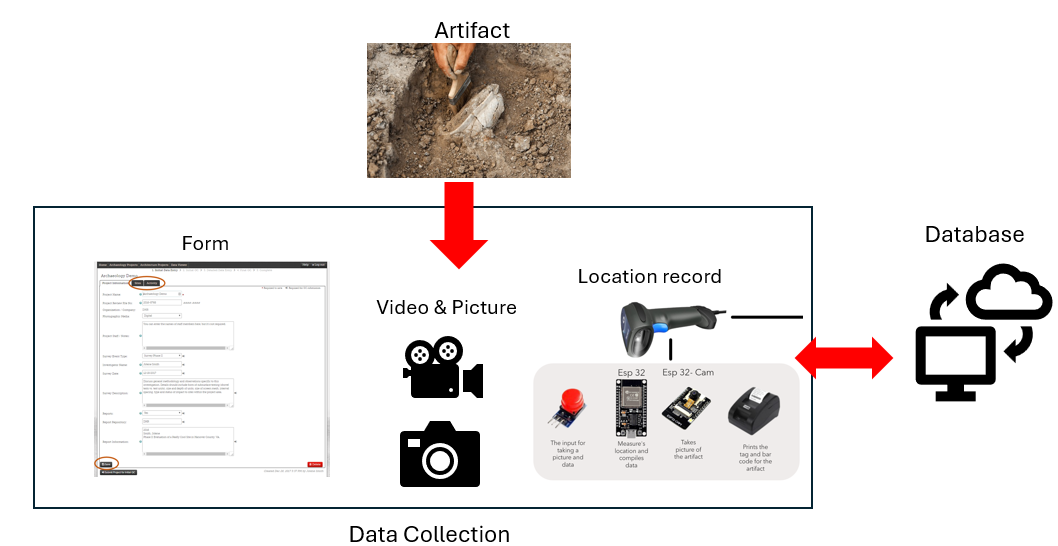
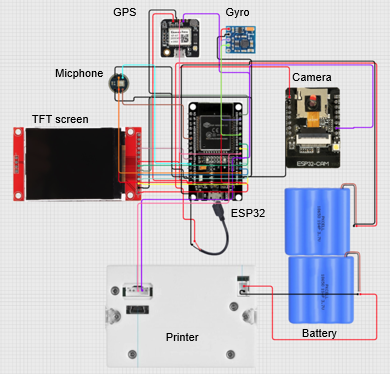
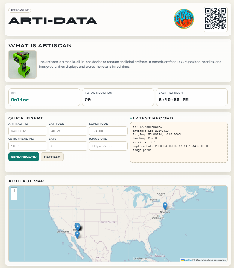
ArtiScan! A mobile, all-in-one device, to capture and label artifacts efficiently. ArtiScan integrates multiple separate devices including a camera, gyro, GPS, and thermal printer all controlled by an ESP32 microcontroller. It connects to a database to store all the data captured.
Prototypes
In our innovation project, we designed a total of four prototypes to continue improving our design.
Diagram of initial concept:
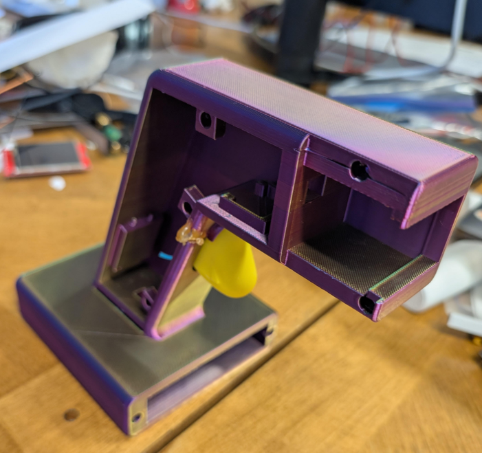
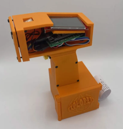
Prototype 1 (October 2025)
First 3D printed casing, Preliminary circuit design, First pass component selection
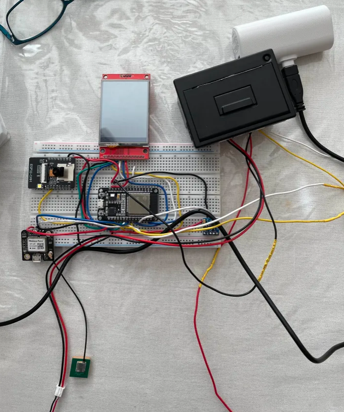
Prototype 2 (Dec 2025)
Fully integrated circuit, first program completed, new casing to address environmental risks, switched to ESP32 addressing lack of Wi-Fi signal on the sites
Prototype 3 (Jan 2026)
Redesigned casing to improve component position and handling
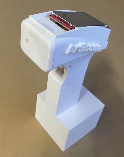
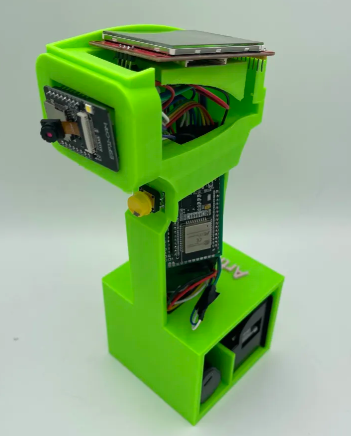
Prototype 4 (March 2026)
Final Design, Integration of cloud and Bluetooth database, field testing (See database section ...)
Database
Local database
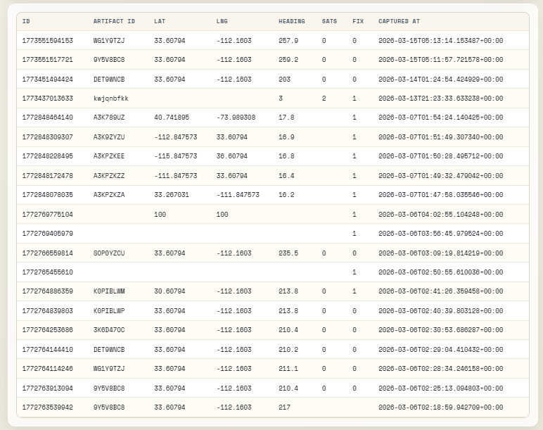
A local database stores ArtiScan’s data directly on the device, keeping details like location, artifact ID, and time of discovery organized, but the information can be lost when the page is refreshed or the device is closed, making it less reliable than cloud storage.
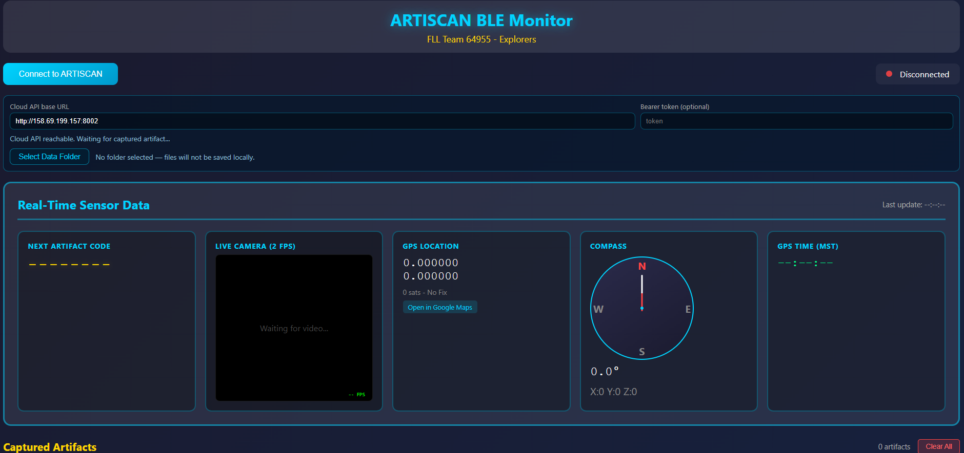
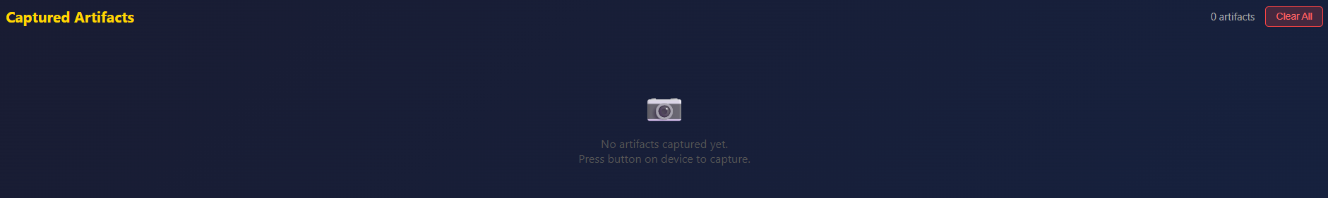
Cloud database
The cloud database stores ArtiScan’s collected data—such as location, artifact ID, and time of discovery—in a clean and organized way. Because the information is saved remotely, it remains available even if you refresh or reopen the page. You can access it here: http://explorerslab.org:8002/
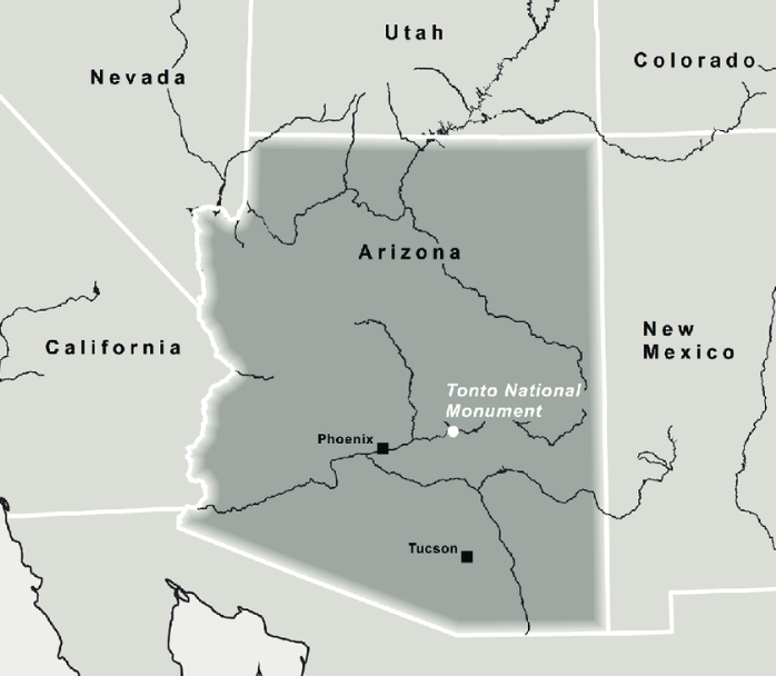
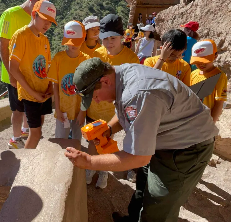
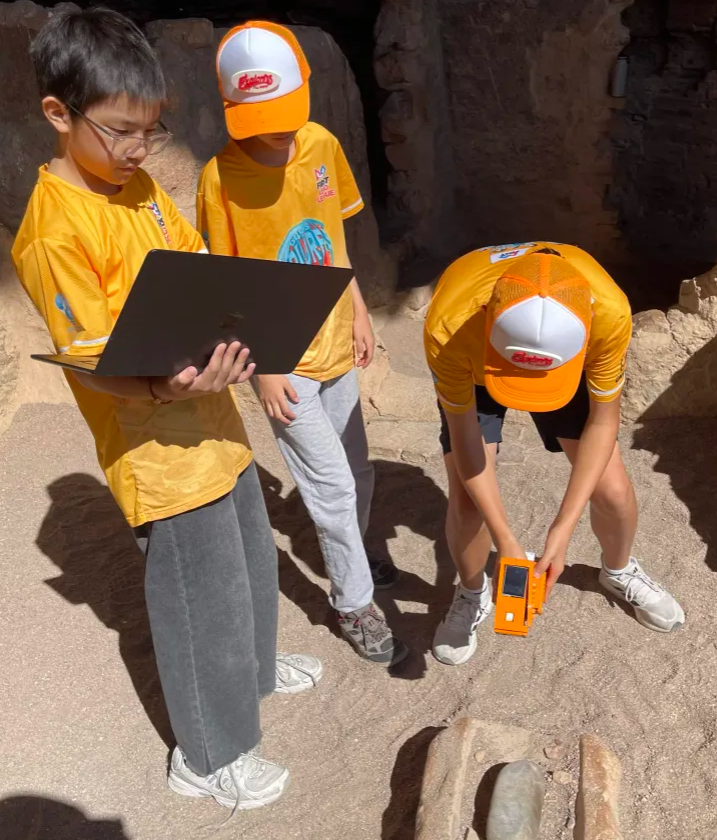
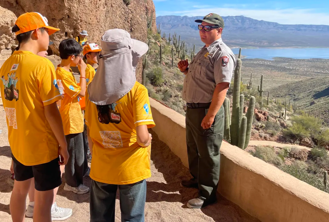
Testing ArtiScan and its Impact in Tonto National Monument
Our team visited Tonto National Monument to test ArtiScan in a real archaeological setting. While we were there, we spoke with a park ranger who shared the history of the site and the people who once lived in cliff dwellings. He even tried out ArtiScan himself. The visit helped us see how ArtiScan performs in the field and how professionals might use it.